2022
Greenland
"Greenland was for me the next level iteration of that classic outdoor adventure"
Greenland is the world’s largest island, and 80% of it is covered in ice. The only ice-free land is along the coast, running inland for 20-100 miles or 40 -160km on average. Fjords criss-cross this landscape all along the coast, and along with large rivers, making a continuous hiking traverse all but impossible. That’s where the packrafts come in. By carrying a packraft, we can cross most of the liquid barriers that we encounter, and a longer trek in Greenland becomes possible.
I'm carrying 10 pounds (5 kilogram) of camera gear, over 12 pounds (6 kilogram) of packrafting equipment, and 13 days of non-dehydrated (heavy) food. I remember taking my first steps on a slope of loose scree with 75 pounds (34 kilogram) on my back and thinking, no way, this isn't going to be possible. A month of this? But when you put yourself in these kinds of situations, you really don't have a choice. You just do it, and surprise yourself in the process. I think everyone learns this lesson in some form over the course of their backpacking adventures, but you can always take that lesson to another level. That’s what Greenland was for me, the next level iteration of that classic outdoor adventure epiphany; holy shit, I can do it!
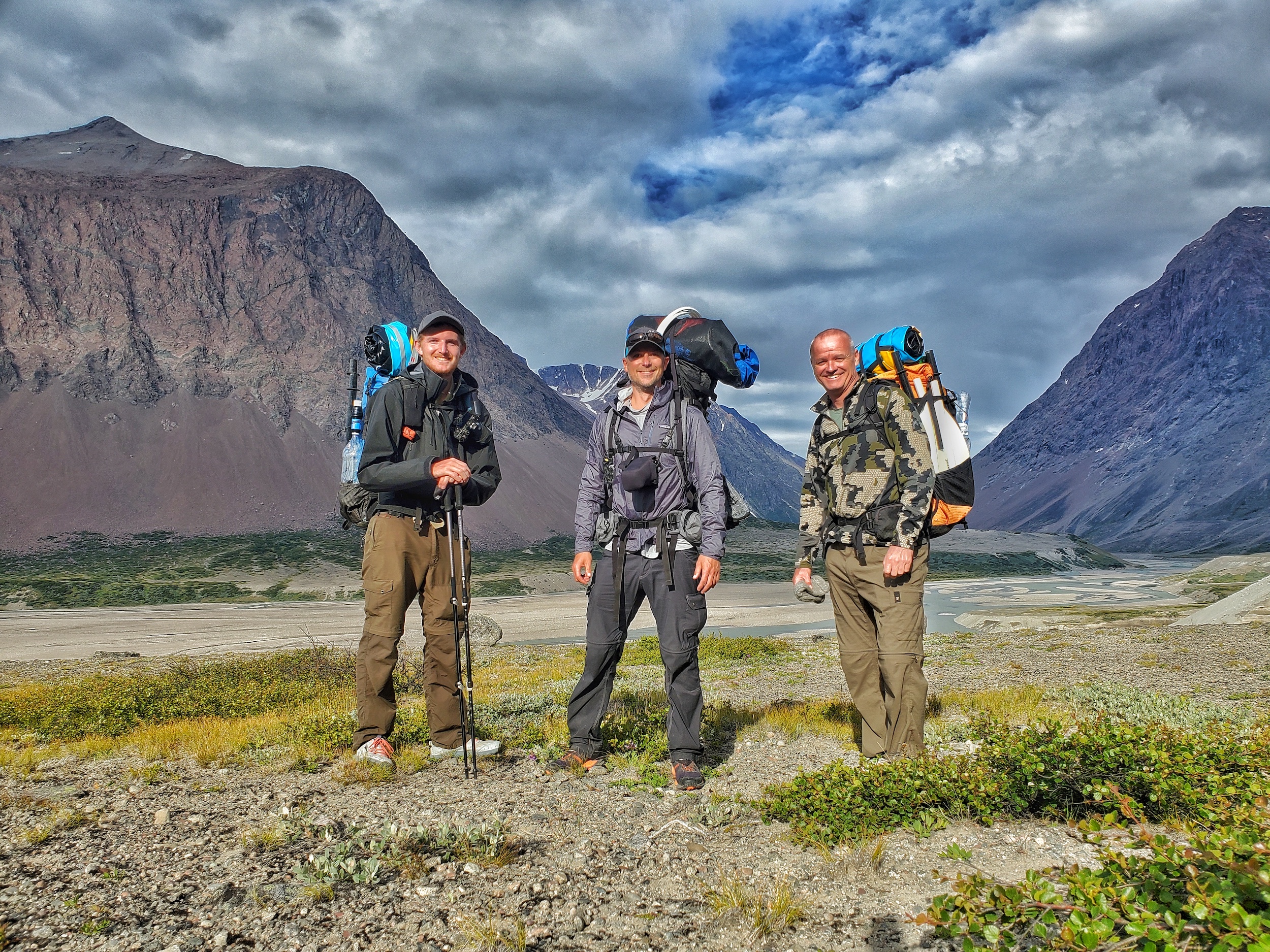
We sent the food box to arrive roughly at the same time we arrive - hopefully
My friends Sam and Ken join me for this adventure. Our plan for southern Greenland consists of two legs; 13 days from Narsarsuaq to Tasiusaq, and a 7 day loop out of Tasiusaq. There are only two cities in the world that offer flights to Greenland. We chose to fly out of Copenhagen. Here, we bought most of our food for the trip and brought it into Greenland with us. Good call, because the stores in Greenland don’t offer much. In Narsarsuaq, we box up 7 days of food and ask around town about how to send this box to Tasiusaq. We are able to pay to have the package delivered by ship, but it will take 2 weeks. This puts the food box there roughly the same time we arrive. Hopefully, anyways.
The locals tell us no polar bears have been spotted in the area recently, so that puts us at ease. We hire a small boat at the harbor in Narsarsuaq to drop us off 10 miles /16km up the iceberg-riddled fjord to start our hike. We jump ashore and we’re left to the silence of Greenland as the boat speeds away. That’s it, we’re here and on our own, it’s real!
Massive glaciers of blue ice spill out from the Greenland Ice Sheet and fill entire valley
It takes some time to adjust to our surroundings; 5,000ft / 1500m peaks rising from sea level, braided glacial rivers, waterfalls pouring out of the clouds. Then, there’s the ice and glaciers. Massive glaciers of blue ice spill out from the Greenland Ice Sheet and fill entire valleys. Most valleys show the current level of glacial ice sitting well below the vegetation line on the surrounding mountainside, an indicator of how thick the ice once was, just a century ago.
After 1.5 days hiking up a glacial river valley, we climb up a ridgeline and overlook a massive glacier-filled valley. The meltwater from these glaciers forms a river, which we’ll paddle downstream for a few miles. It’s an exhausting bushwhack down to the river, where we camp along it. The next day, we inflate our packrafts for the first time. The frigid, fast-flowing milky water looks intimidating, but it’s generally not that deep. We paddle down a network of braided channels, ultimately crossing to the other side of the river.
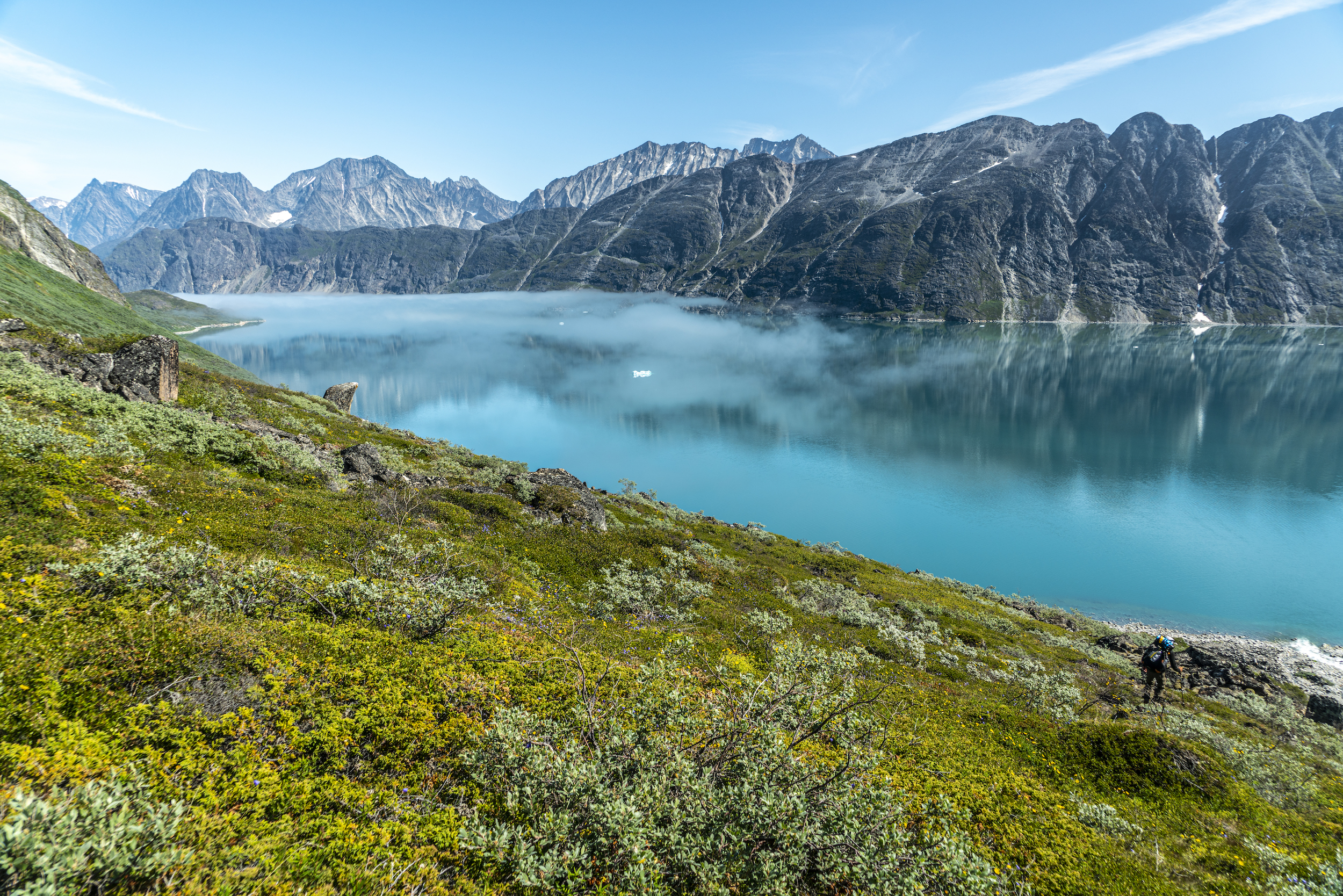
Holes in the ground capable of swallowing legs to the crotch
From here, it was another day or so of bushwhacking. We push through willows 7ft / 2m high that hide holes in the ground capable of swallowing legs to the crotch. The willows grab your feet and legs, acting like resistance bands. It’s incredibly tiring. Large parts of the hike involve this kind of bushwhacking. The bugs also start to get worse. There are swarms of tiny flies that always find their way into eyes and ears, so we start wearing our mosquito head nets. Living in them is probably a better term. They are on from sun up to sundown, we eat and brush our teeth in them. At one point, my head net stays on for 4 straight days.
A fire on the beach – a delicious treat to restore energy and morale
We paddle across a lake which holds back water on the only dam in Greenland. The tiny “village” of Qorlortorsauq lies below, population 4. There are 3-4 buildings, but the town appears empty. There’s a small harbor, and we find an open shipping container to sleep in for the night, avoiding the oncoming rainstorm and allowing us to dry out. We also do some fishing, harvesting several Arctic Char for dinner. We build a fire on the beach and cook our catch, a delicious treat to restore energy and morale.
We paddle Amitsuarssuk Fjord and get up close to several large icebergs. On the other side, we begin another horrendous bushwhack. Then its miles of wet bogs to cross, which has 12-18 inches of play when stepped upon. This makes it more exhausting to walk through than deep sand. After that, another horrible bushwhack on a steep slope. The views are otherworldly, but so is the effort involved to reach these places.
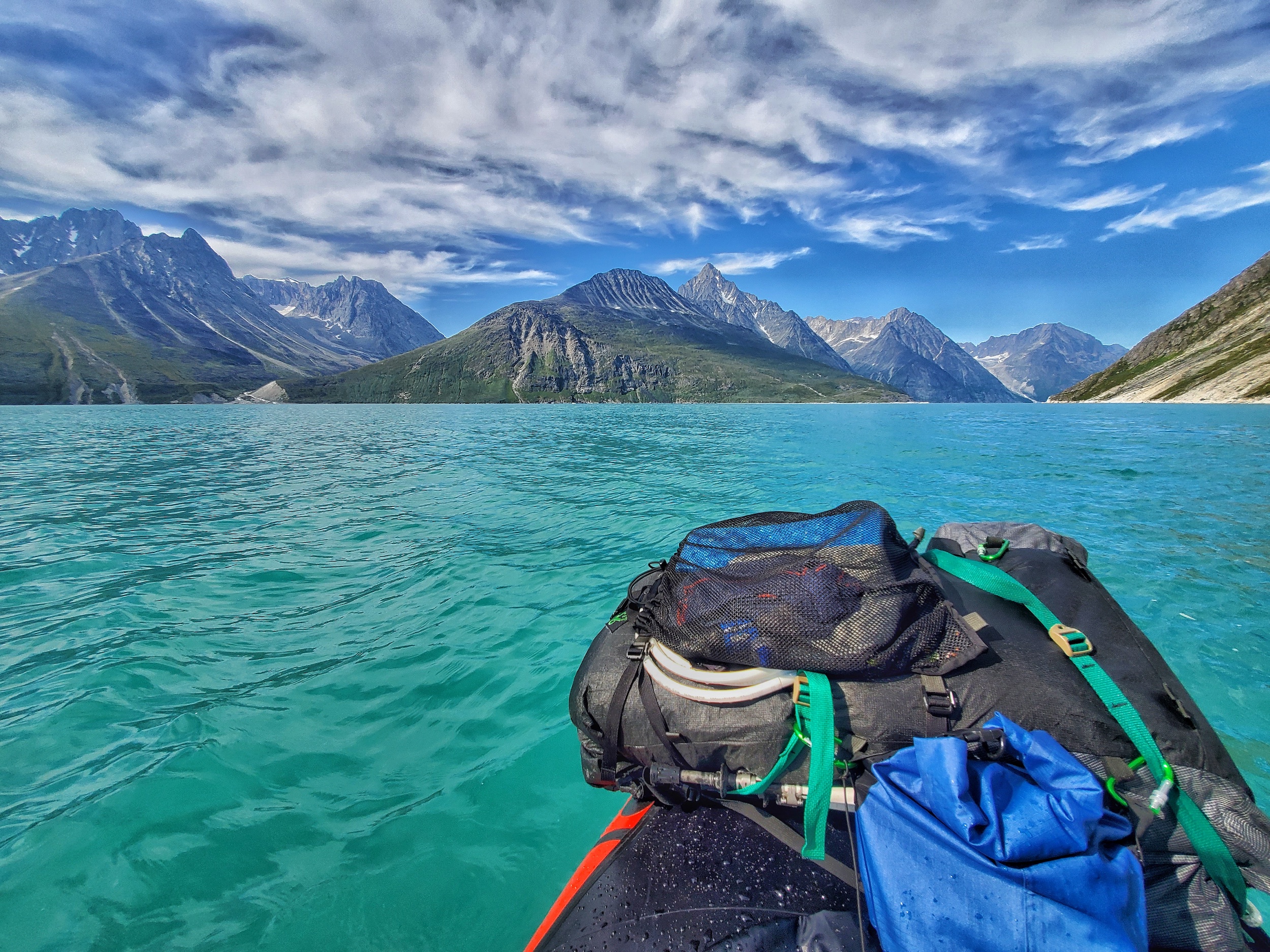
Very close to being swept away
Day 7, more insane bushwhacking. We reach a raging river and find a calmer and wider section of the river to paddle across. Farther up the river, we ford it to avoid blowing up our boats again. I found the deepest spot, belly button deep and fast flowing. All 3 of us rate that river a 95% of our ability to not be swept away. I know I was very close.
The next day, we begin to climb up to a high pass in the valley. It’s just boulders now, no more bushes to whack. We pass alpine lakes, snow fields and glacial ice on the way up to 4,200ft / 1300m the high point of our Greenland adventure. From here, the Greenland Ice Sheet can be seen in the distance as it blends into the sky.
Next, we must descend another difficult valley down to a fjord. We walk through the water of a glacial stream to avoid the rocky terrain along its banks, and the water leads us to an overlook of the Fjord. A cloud inversion has the water completely covered with fog. The descent down is tedious and treacherous, but the clouds lift just as we approach the fjord.
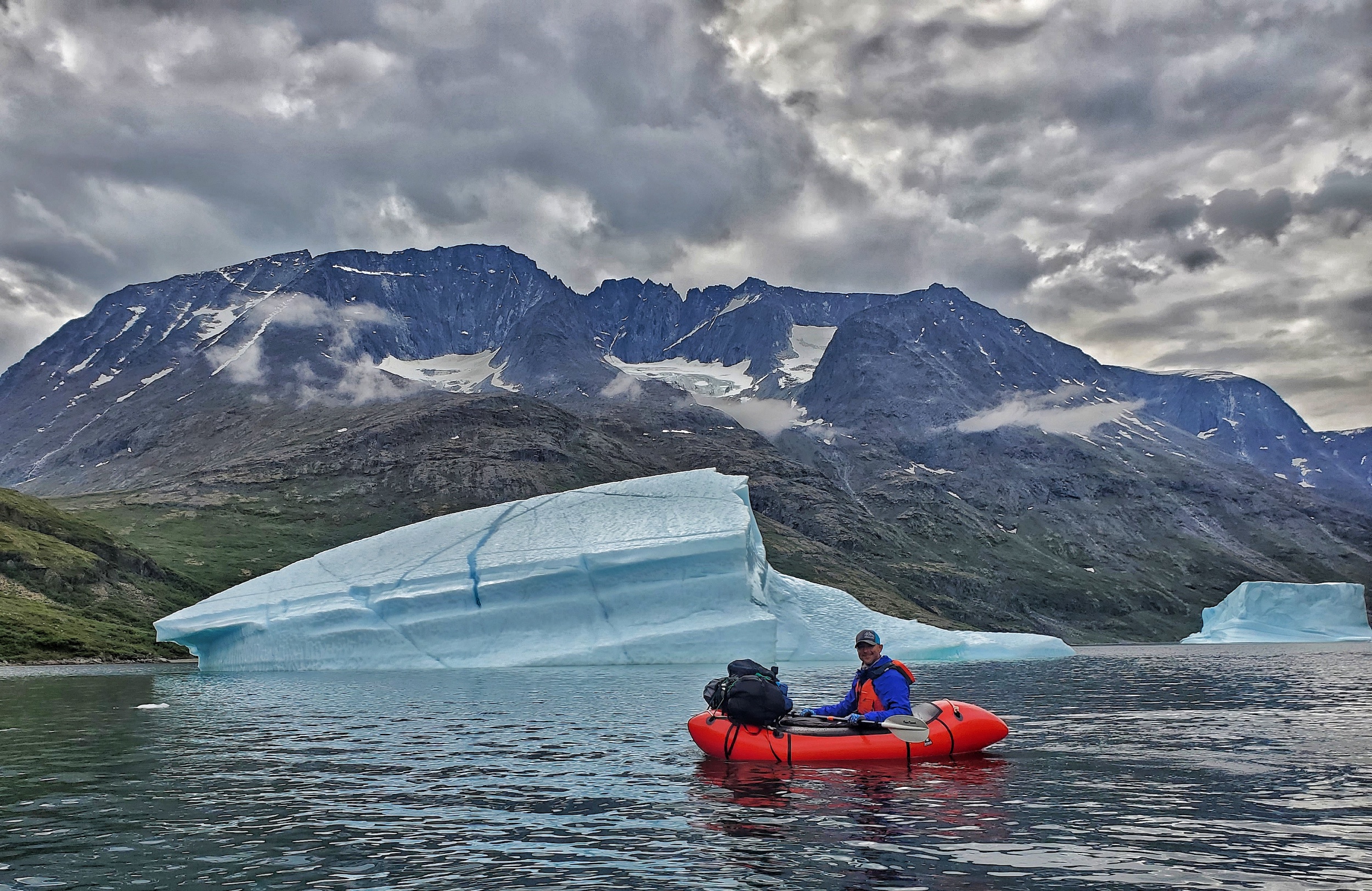
Immersion in this water would be very bad
The waters of Sondre Sermalik Fjord look calm when we start to cross, but during the 2.5 mile / 4km open water crossing, the winds pick up. Then, it’s another 1.5 miles / 2.5km of paddling along a shoreline of cliffs. We round a point and the full force of the wind hits us. The waves are 3ft / 1m high now, and seem to be getting larger. We have no dry suits, so immersion in this water would be very bad. We find an emergency spot to take out, along a rocky indent among the cliffs. We climb out of this “cave” and onto the very steep and thickly vegetated slopes of the cliffs that we were trying to paddle around in the first place. But at least here, we feel safer.
We spend another day bushwhacking up a valley before reaching Tasermiut Fjord. The scenery here is stunning; a wall of ice that spills 5,000ft / 1500m down a valley from the Ice Sheet above, pointy peaks, waterfalls, and one of the tallest vertical rock faces in the world (Mt. Ketil). The next day, bad weather keeps us in our tents for a few hours, and we get a late start paddling across the fjord. The water is a beautiful turquoise blue color, almost tropical looking if it weren’t for all the ice around.
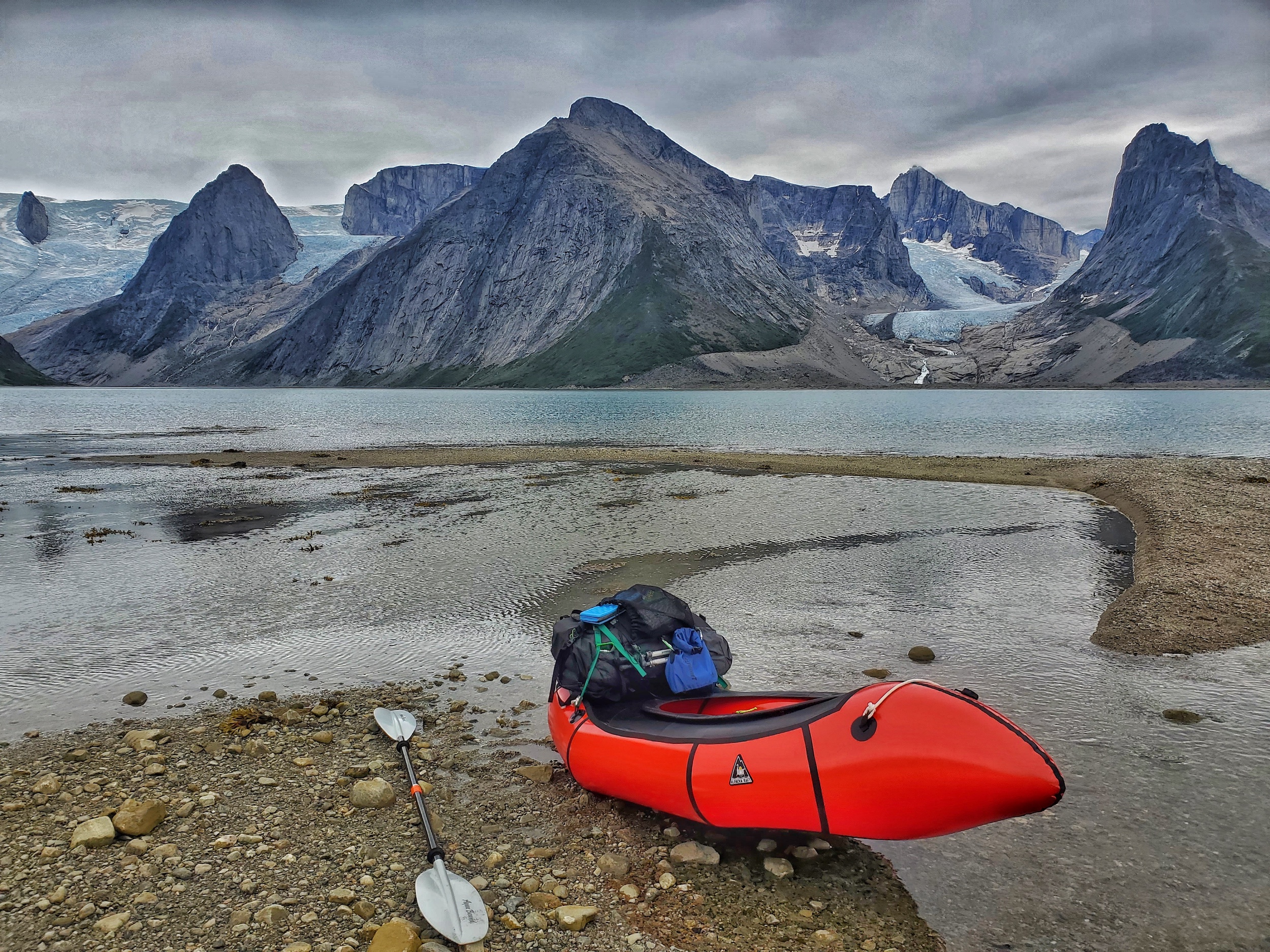
Curious seals follow our packrafts
We now have 25 miles / 40km of paddling to do on Tasermiut Fjord. We camp 3 nights along the water as we work our way south. Curious seals follow our packrafts, popping their heads up out of the water from time to time. We spot an actic fox on the shore, and see the fin of a whale as it comes up to breathe.
On day 13, we reach Tasiusaq, a small and remote village, home to less than 100 people. We are able to rent a room for a couple of nights, but there is no running water in the house. A few days later, our food box arrives at the store, and we are able to continue on the next leg of our journey.
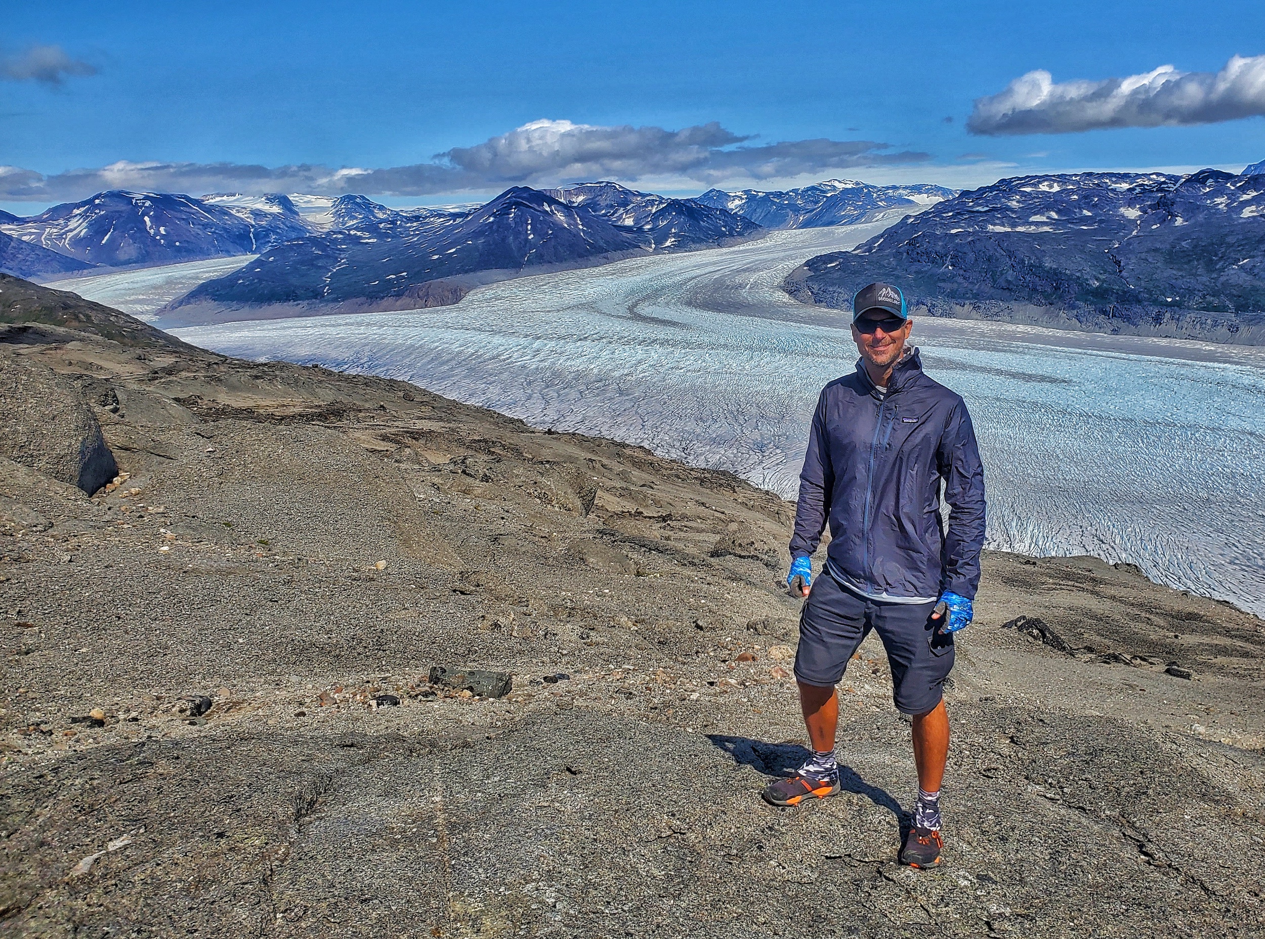
Another 6 hours of horrible bushwhacking
Next, we’ll embark on a 7 day loop hike, returning to Tasiusaq. We climb up a ridge above the valley to a series of alpine lakes among boulders. There’s a fair amount of snow here, some stunning lakes with outstanding clarity and color, then a hairy descent down a steep and loose scree field. A brief interlude of a majestic valley is promptly interrupted by another 6 hours of horrible bushwhacking.
Outstanding scenery as we crest a pass and drop down into another valley leading to Kangerluk Fjord. There are several icebergs floating around here. We climb up another scenic valley to a pass, kick steps in the snow to cross the slopes above a few frozen alpine lakes, and hike the base of a glacier clinging to a steep slope. We hike up a ridgeline and follow this to its end, 2,800ft above the fjord below. It’s an incredible panorama view, but it’s begun to rain and we’re now being overtaken by clouds. We set up our tents just before the deluge.
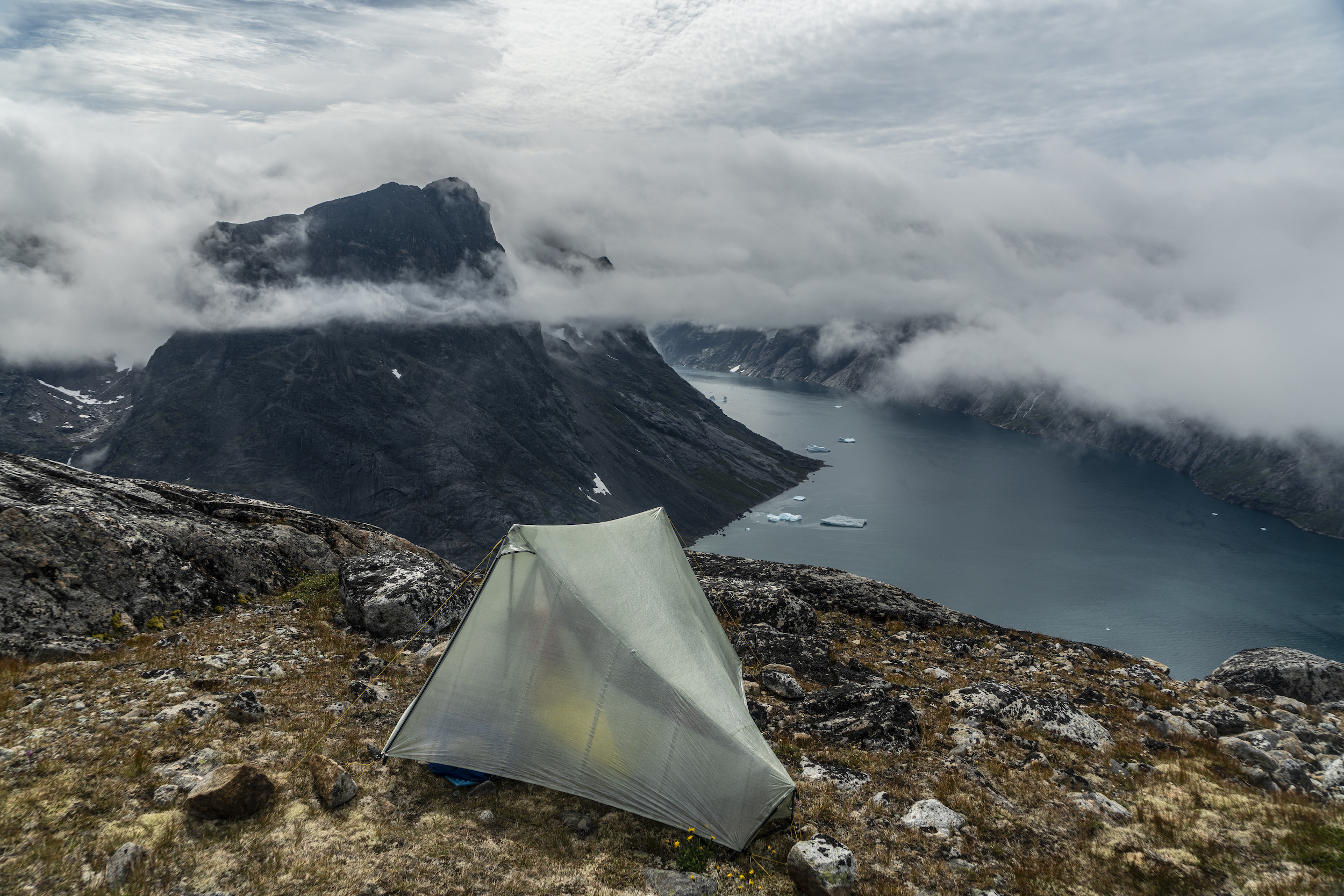
We pinned down our tents for 18h before we could move on
The rainstorm we experienced atop those cliffs was probably the most intense rainstorm I’ve ever experienced in a tent. We were basically sitting in the clouds. It was freaky, the way the light fluctuated as the dark parts of the clouds pass through my tent. It rained for about 10 straight hours, and for much of that time, it was just a downpour. We were pinned down in our tents for a total of 18 hours before we could move on.
Next we ford another fast-flowing glacial river, descend a very steep slope to the fjord, and walk its shores at low tide. We cross a few more glacial streams, and enter the final valley. It’s a beautiful sight; the fjord behind and pointy peaks poking out of the clouds ahead.
The last few miles are an underwhelming end to a remarkable journey. It was an arduous trip to the edge of the Earth and back, a place I never dreamed I’d visit. But that’s the beauty of outdoor adventure. Our past accomplishments become our motivation for future adventures. A month of hiking and packrafting in Greenland? I wouldn’t have committed to this a few years ago. Tomorrow, who knows what’s next?
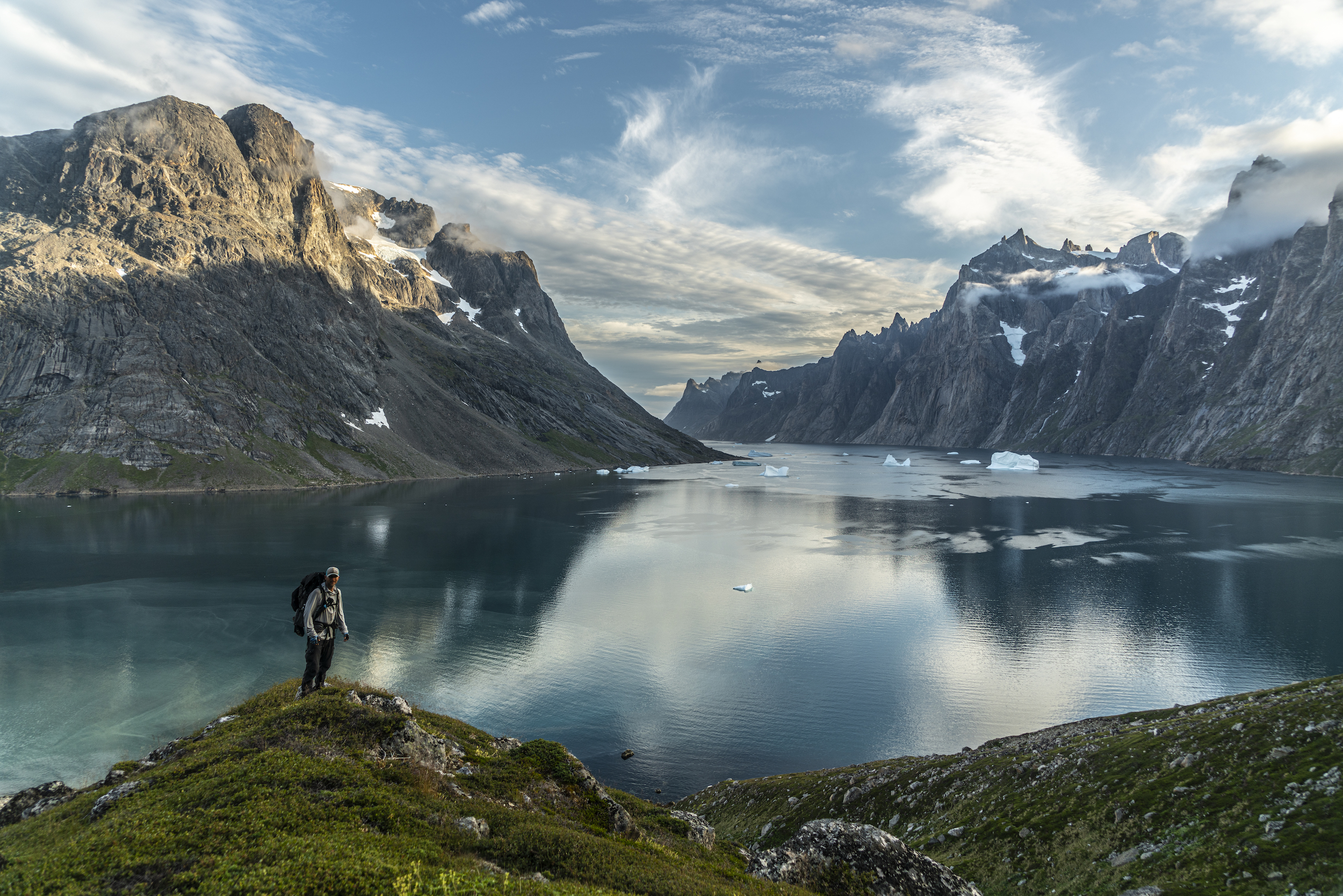
About Eric
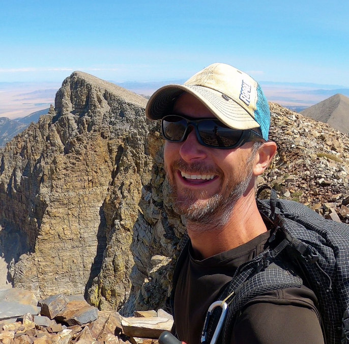
Eric Poulin is an outdoor photographer, amateur film maker and youtuber. Watch his latest film, Pioneering Nevada’s Basin and Range Trail, on Amazon Prime, Tubi and other streaming platforms.
Youtube: https://www.youtube.com/c/seekinglost
Instagram: https://www.instagram.com/seekinglost/
Facebook: https://www.facebook.com/seekinglost
Website: https://seekinglost.com/
More to explore
Sign up to stay updated
by clicking "Sign up" you agree that the World Explorers Collective can use your email address to contact you and use your data in accordance with EU data protection law
